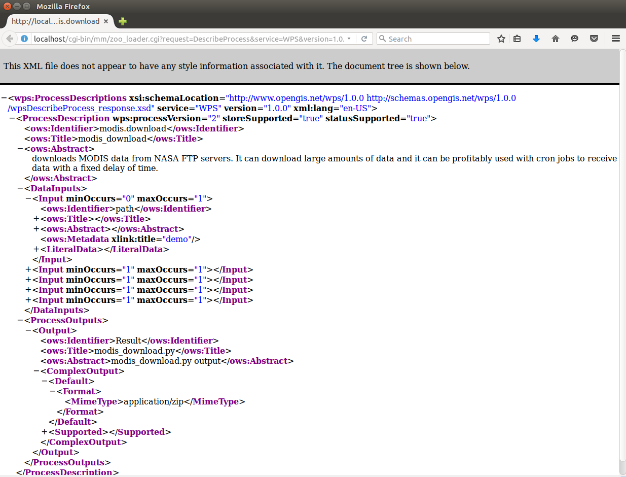
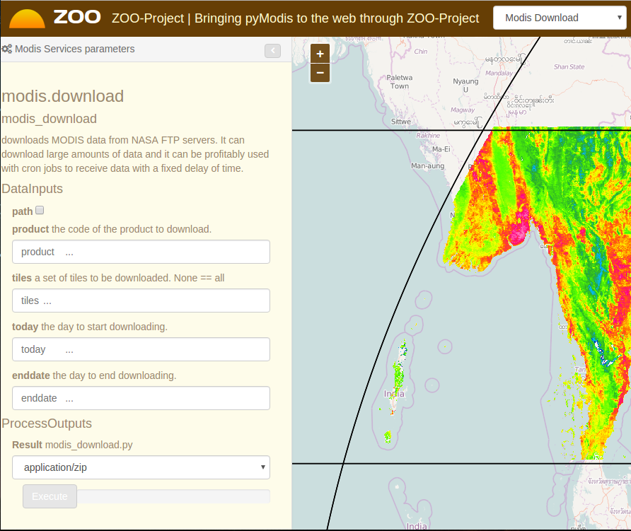
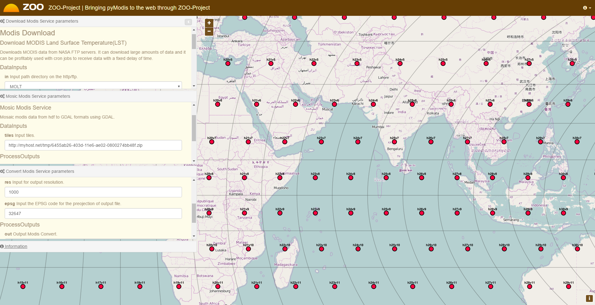
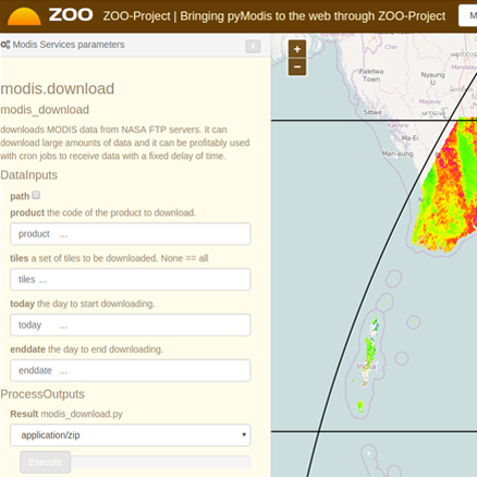
Download data (modis.download)
For first you need to obtain MODIS data, so you need to use downmodis module.
An idea which can be implemented for the future, based on this initial work,
include the creation of new services by combining pyModis, GRASS, OTB and SAGA-GIS services.
The pyModis project has been developed and used to work with MODIS data, it provides wxPython user interfaces which are able to download and process data using pyModis scripts. pyModis depends on a desktop graphical user interface which does not make it directly usable from a web application. The idea of this GSoC proposal is to bring pyModis to the web by publishing Python Web Processing Services using the ZOO-Project technology accessible through a minimal web application.
Currently pyModis is able to run on a local computer but cannot be directly remotely invoked on-demand. ZOO-Project is able to handle services implemented in the Python language but do not offer any pyModis capabilities.
By providing pyModis as a service through ZOO-Project, capabilities of ZOO-Project will be increased, specially capabilities of
python in ZOO-Project will be exposed. As a sample web service from this, we develop a web service to download, mosaic and convert
modis data from NASA's Land Processes Distributed Active Archive Center (LP DAAC) (http://e4ftl01.cr.usgs.gov/).
Then, it could be
useful to whoever that want to download data, mosaic images and convert modis data from image to another image file without GIS and
Remote Sensing knowledge.
For first you need to obtain MODIS data, so you need to use downmodis module.
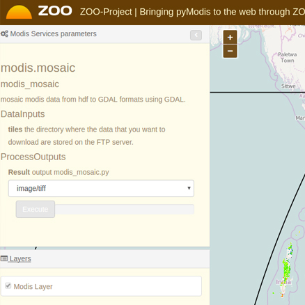
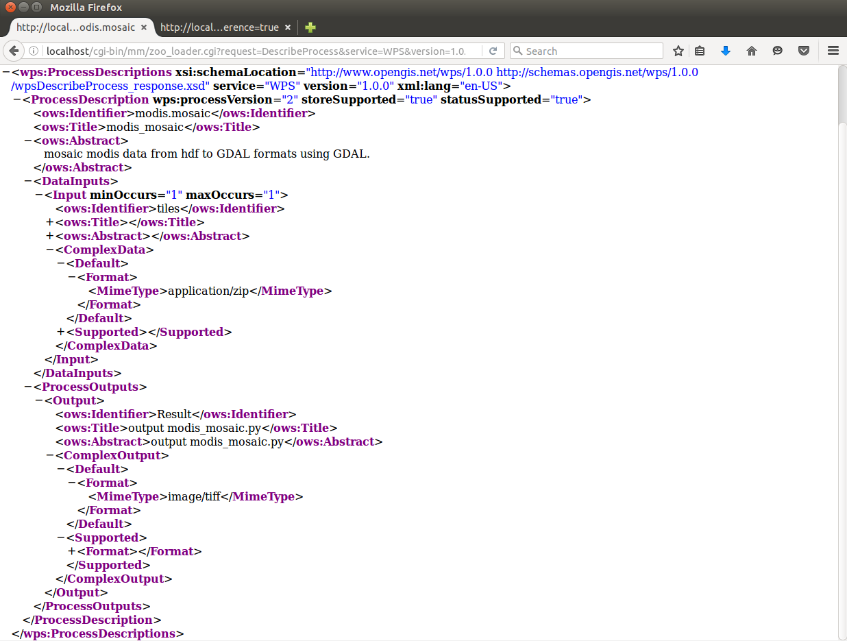
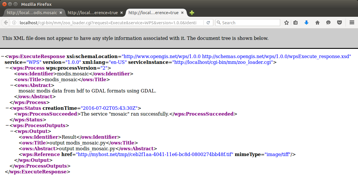
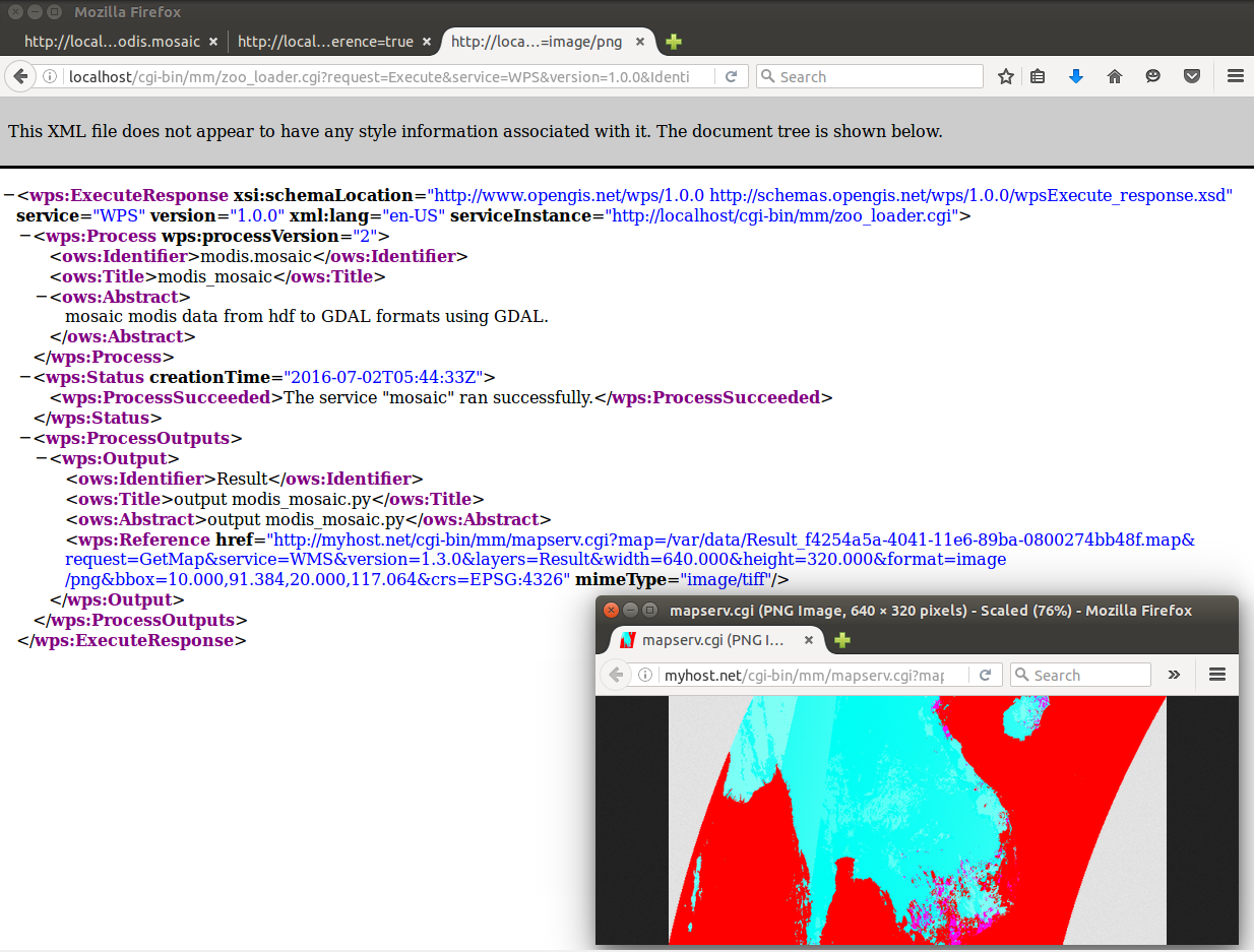
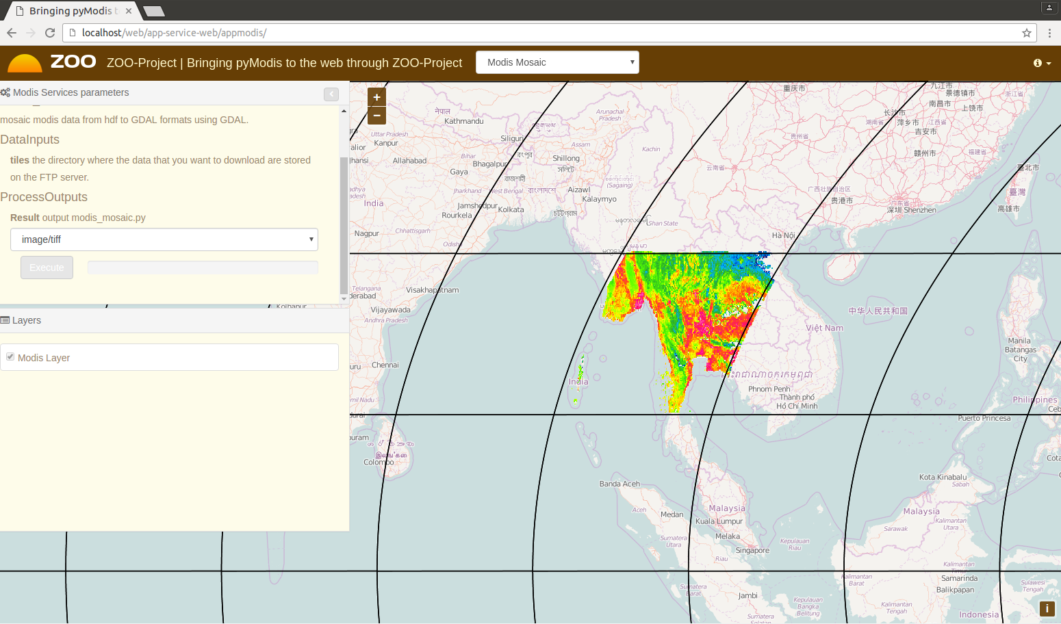
Mosaic MODIS data from hdf to GDAL formats using GDAL.
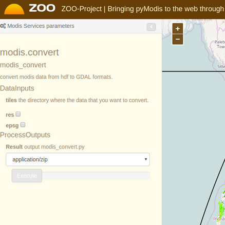
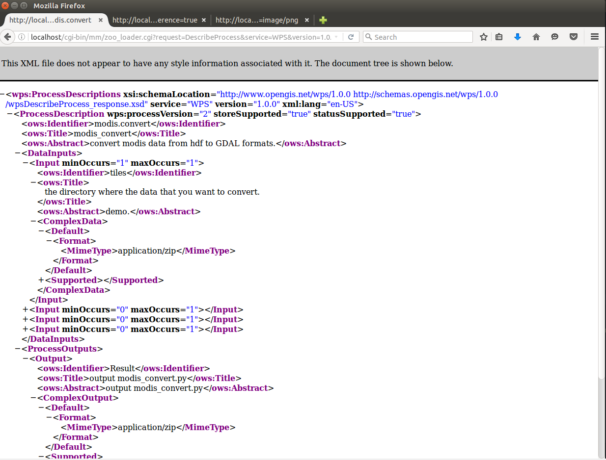
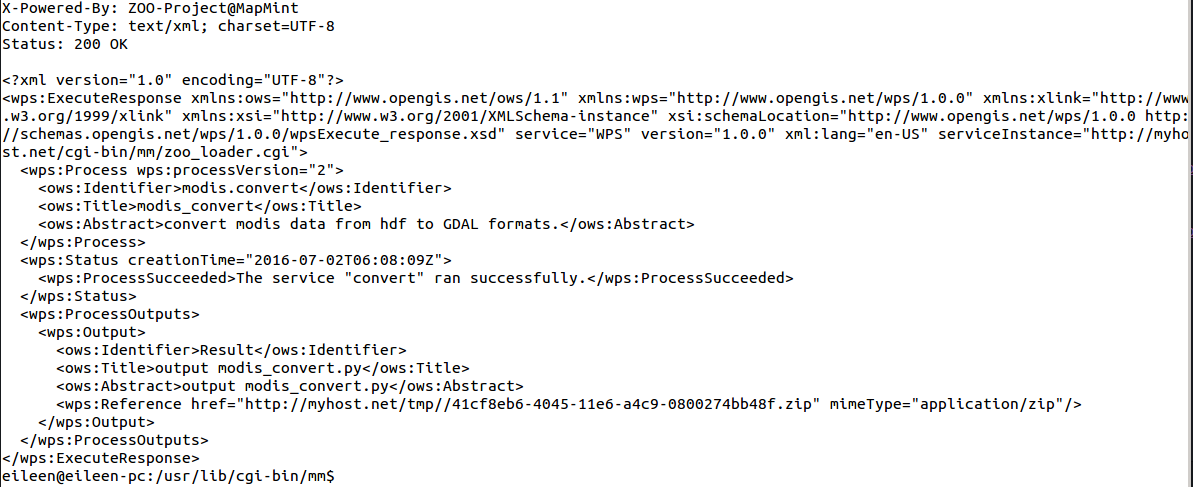
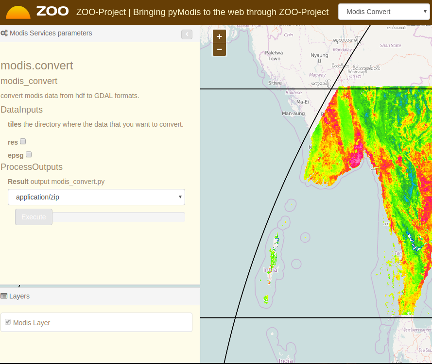
Convert MODIS data from hdf to GDAL formats using GDAL.
Create ZOO Service Configuration File(ZCFG) and Implementation the Python Service